Location: West Java Map
Area: 155 km2
Gunung Ciremai National Park is a biosphere reserve situated in the West Java Island in Indonesia. Gunung Ciremai National Park covers a total area of 155 km2.
The shape of the Gunung Ciremai National Park region tends to
rise, with a long axis almost exactly north-south, and with three
longitudinal ridges similar to the cape in the north, west and
southwest. This region is between the longitude of 108 ° 21'35 "-108
° 28'00" East Longitude and latitudes of 6 ° 50'25 "-6 ° 58'26" LS.
The topography is mostly bumpy (64%) and steep (22%), mountainous,
with the highest peak at an altitude of 3078 m asl.
The TNGC area is partly included in the Kuningan Regency area
(8,931.27 ha), and partly in the Majalengka Regency area (6,927.9
ha). However, the area of TNGC which is legally valid and in
accordance with the Forestry Minister's Decree is ± 15,500 Ha. In
the north the forest area is bordered by the area of Cirebon
Regency; while the boundaries on the east side are located in the
districts of Cilimus, Jalaksana, and Kramatmulya. In the south,
these boundaries are in the areas of Cigugur, Kadugede, Nusaherang,
and Darma; in the west are in the Majalengka region.
In this Ceremai Mountain
region, the forest below 1,000 m was originally a production
forest area managed by Perhutani KPH Kuningan. These forests
have been turned into pine plantations and several other types
of wood trees. While forests at an altitude of 1,000 m above
were previously protected forests, some of which have been
damaged disturbed by volcanic eruptions, and then by community
activities and forest fires. Based on the climatic conditions,
these mountain forests can be distinguished from wet highland
forests in the south (Cigugur and its surroundings) and drier
upland forests in the north in the Setianegara region and
beyond.
The forest in the wet mountain zone from Cigugur to the top of
Ceremai is quite rich in tree species. Among these are species
of saninten (Castanopsis argentea, C. javanica, C. tungurrut)
and pairs (Lithocarpus elegans and L. sundaicus) of the Fagaceae
tribe; jenitri (Elaeocarpus obtusus, E. petiolatus and E.
stipularis), Elaeocarpaceae tribe; mara (Macaranga denticulata)
and kareumbi (Omalanthus populneus), Euphorbiaceae tribe;
various types (Symplocos fasciculata, S. spicata, S.
sessilifolia, S. theaefolia), Symplocaceae; types of figs
(including Ficus padana and F. racemosa), Moraceae; puspa
(Schima wallichii) and ki broom (Eurya acuminata), Theaceae; and
others.
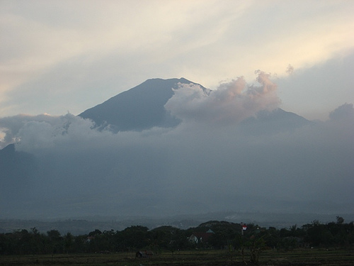
Topography
The topography of Mount Ceremai is usually rocky,
hilly, and mountainous with a convex shape at the top Mountain
topography also has variations from flat, low to steep terrain.
Whereas the sloping position of the soil ranges from 0-80 / 0 or
only 26.52% and above 8% (73,480 / 0) Whereas the prevailing
climate is with an average rainfall of 2,000-4,000 mm / year
with air in the ice with air temperature between 18-22 degrees
Celsius. Whereas the topography varies from the east with a
higher sloping position and the land to the south with a sloping
sloping position.
Climb Path
If you want to reach the
top of Mount Ceremai can be climbed from many hiking trails. But
the most famous and easily accessible hiking trails are
Palutungan and Linggarjati villages in Kuningan Regency and Apuy
Village in Majalengka Regency. The most commonly used climbing
route is from Padabeunghar Village in the border area of
Kuningan and Majalengka in the north. The city of Delhi is the
nature lovers Root (subsidiary Brass Natural Forest) that will
help them citing the information and guidance when I climbed the
mountain Ceremai.