Location: Alexander City, Alabama Map
Area: 2,040 acres (8.26 km2)
Horseshoe Bend National Military Park, located in Tallapoosa County, Alabama, is a 2,040-acre historic site managed by the National Park Service. It preserves the location of the Battle of Horseshoe Bend, fought on March 27, 1814, a pivotal engagement that marked the end of the Creek War (1813–1814), considered part of the broader War of 1812. The battle saw Major General Andrew Jackson’s forces, numbering approximately 3,300, decisively defeat around 1,000 Red Stick Creek warriors led by Chief Menawa, resulting in over 800 Creek deaths—the largest single loss of Native American lives in a U.S. battle. The battle’s outcome led to the Treaty of Fort Jackson, ceding 23 million acres of Creek land, shaping the formation of Alabama and parts of Georgia, and propelling Andrew Jackson to national prominence, culminating in his presidency in 1828.
The Creek War and Its Origins
The Creek War (1813–1814) arose from
internal divisions within the Creek (Muscogee) Nation and external
pressures from American expansion. The Creek Nation, originally
descendants of Mississippian mound-building cultures, had formed a
confederacy of towns across present-day Alabama, Georgia, Florida, and
the Carolinas. By the early 19th century, they were divided into two
factions:
Lower Creeks, who favored accommodation with the United
States and adopted aspects of European-American culture.
Upper
Creeks, or Red Sticks, who resisted American encroachment and sought to
preserve traditional ways. The Red Sticks, named for their red war clubs
symbolizing war, were influenced by the Shawnee prophet Tecumseh’s call
for Native resistance against U.S. expansion.
Tensions escalated
after the 1813 Fort Mims massacre, where Red Sticks killed about 250
settlers, prompting a U.S. military response. Andrew Jackson, a
Tennessee militia general, was tasked with subduing the Red Sticks,
leading to a series of engagements culminating at Horseshoe Bend.
The Battle of Horseshoe Bend
On March 27, 1814, Jackson’s
army—comprising 2,000 Tennessee militia, the 39th U.S. Infantry
Regiment, 700 mounted infantry, and 600 Cherokee and Lower Creek
allies—attacked the Red Stick village of Tohopeka, located within a
horseshoe-shaped bend of the Tallapoosa River, known as Cholocco
Litabixee (“Horse’s Flat Foot”). The Red Sticks, under Chief Menawa, had
fortified their position with a 400-yard-long log-and-dirt barricade
across the neck of the peninsula, relying on the river’s natural
defenses.
Battle Strategy:
On March 22, Jackson’s forces
marched from Fort Williams, cutting a 52-mile trail through the forest.
On March 26, they camped six miles north of Tohopeka.
On the morning
of March 27, Jackson sent Brigadier General John Coffee with 700 mounted
infantry and 600 Cherokee and Lower Creek warriors three miles
downstream to cross the Tallapoosa and encircle the bend, cutting off
Red Stick escape routes.
At 10:30 AM, Jackson initiated a two-hour
artillery bombardment of the barricade, which proved ineffective due to
its sturdy construction.
By noon, Coffee’s Cherokee allies, including
warriors like Sequoyah, swam the river and attacked the Red Sticks from
the rear, setting fire to Tohopeka village. This distraction allowed
Jackson’s main force to storm the barricade.
By sunset, the battle
was over. Of the 1,000 Red Sticks, approximately 800 were killed, with
only 200 surviving. Jackson’s losses were minimal: 49 killed and 154
wounded. Notable figures wounded included Sam Houston, later a key
figure in Texas history.
Aftermath:
The battle broke the power
of the Red Stick faction and effectively ended the Creek War. Chief
Menawa, though wounded, escaped but surrendered in August 1814 at
Wetumpka.
On August 9, 1814, the Treaty of Fort Jackson forced the
Creek Nation—both Upper and Lower Creeks—to cede 23 million acres
(approximately 9.3 million hectares), nearly half their ancestral lands,
to the United States. This land formed much of Alabama (admitted to the
Union in 1819) and parts of Georgia, accelerating U.S. westward
expansion.
The victory elevated Jackson’s status as a national hero,
further cemented by his success at the Battle of New Orleans (1815),
leading to his election as the seventh U.S. President in 1828.
Surviving Red Sticks fled to Florida, joining the Seminoles,
contributing to later conflicts like the First Seminole War. The Creek
Nation faced further displacement during the Trail of Tears in the
1830s, forcibly relocated to Oklahoma under Jackson’s Indian Removal
Act.
Critical Perspective
The battle is often framed as a U.S.
triumph, but it represents a tragic loss for the Creek Nation, whose
defeat facilitated the dispossession of their homeland. The involvement
of Cherokee and Lower Creek allies highlights the complex alliances and
divisions among Native groups, often exploited by U.S. forces. Jackson’s
role, while celebrated in American narratives, is increasingly
scrutinized for his ruthless tactics and later policies that devastated
Native communities. The park’s interpretive materials strive to balance
these perspectives, acknowledging both the military significance and the
human cost.
The preservation of Horseshoe Bend as a national park was a concerted
effort driven by local and federal initiatives:
In the 1920s,
Alabama Power Company considered damming the Tallapoosa River, which
would have flooded the battlefield to create Lake Martin. Thomas Martin,
an Alabama Power executive, recognized the site’s historical value and
advocated for its preservation, convincing the company to abandon the
dam plan.
Martin, along with Judge Clinton Jackson Coley and Thomas
D. Russell of Russell Corporation, formed the Horseshoe Bend Battle Park
Association. They secured donations of 2,040 acres, including land from
Alabama Power, and transferred it to the federal government.
On July
25, 1956, Congress authorized the park’s establishment, contingent on
the donation of at least 500 acres. The land was formally accepted on
April 24, 1959, and President Dwight D. Eisenhower signed Proclamation
3308 on August 11, 1959, dedicating Horseshoe Bend National Military
Park.
The park officially opened to the public on March 27, 1964,
with the dedication of its Visitor Center. A three-mile tour road was
added in 1965.
Physical Features and Layout
Horseshoe Bend
National Military Park is situated 80 km (50 mi) northeast of
Montgomery, near the town of New Site, with a mailing address in
Daviston (11288 Horseshoe Bend Rd, Daviston, AL 36256). The park’s 2,040
acres encompass the battlefield, the Tallapoosa River’s horseshoe-shaped
bend, and surrounding hilly terrain at the transition of the Blue Ridge
and Piedmont Physiographic Provinces.
Key Features:
Tallapoosa
River and Battlefield:
The park centers on the dramatic bend in the
Tallapoosa River, which provided the Red Sticks’ defensive position. The
river, lined with corn, bean, and squash fields in 1814, remains a
scenic highlight, with its banks accessible for fishing (with an Alabama
state fishing license) and canoeing.
The battlefield includes the
site of the Red Stick barricade, Tohopeka village, and key engagement
points, preserved as open meadows and forested areas.
Visitor
Center:
Open daily from 9:00 AM to 4:30 PM (closed Thanksgiving,
Christmas, and New Year’s Day), the Visitor Center features:
A
22-minute live-action documentary detailing 200 years of Creek history,
the battle, and its aftermath. The film includes war scenes suitable for
children who understand war and death.
A museum with exhibits on
Creek and Cherokee culture, the battle’s causes and consequences, and
artifacts like musket balls, arrowheads, and pottery found on the
battlefield.
An animated lighted map illustrating the battle’s
progression.
A ranger-staffed information desk and a bookstore with
souvenirs.
The Visitor Center, dedicated in 1964, is accessible from
the park’s main entrance and offers free admission.
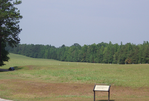
Battlefield
Tour Road:
A 3-mile paved loop road guides visitors through five key
stops, each marked by plaques or exhibits:
Stop 1: Jackson’s initial
camp, where his army arrived on March 26, 1814.
Stop 2: The Red Stick
barricade site, visible up close, showing its strategic placement.
Stop 3: The overlook, offering a panoramic view of the battlefield and
river bend from a covered pavilion.
Stop 4: A hill overlooking
Tohopeka village, burned during the Cherokee rear attack.
Stop 5: The
final battle site, where Jackson’s forces overran the Red Sticks.
Each stop includes an interactive cell phone tour (dial a posted number
for narrated descriptions). Some stops require short walks on footpaths.
Nature Trail:
A 2.8-mile loop trail, starting at the Overlook
parking lot, traverses the battlefield and forested areas. Rated
moderate due to hilly terrain, it crosses a small creek via wooden
footbridges and follows the Tallapoosa River for about a third of a
mile.
The trail passes Tour Stops 2 and 4 but is primarily for
exercise and nature, not additional battle information. Hikers should
beware of fire ants, deer ticks, armadillo holes, and poisonous snakes.
Picnic Areas and Recreation:
Two picnic sites are available,
ideal for families or groups.
The park supports canoeing and kayaking
on the Tallapoosa, with a boat ramp for access. Fishing is permitted at
the boat ramp with a valid license.
Wildlife includes deer, wild
turkeys, and various bird species, with the river and meadows offering
scenic views for photographers.
Geologic and Environmental
Context:
The park lies at the boundary of the Blue Ridge and Piedmont
Physiographic Provinces, characterized by hilly terrain and geologic
formations shared with the broader region. The Tallapoosa River’s bend
is a defining geologic feature, shaping both the battle and the park’s
aesthetic.
A National Park Service Soil Resources Inventory and
Geologic Resources Inventory provide detailed data on the park’s soils
and geology, accessible via the NPS Data Store.
Summer temperatures
can reach 90°F (32°C), with high humidity and intense sun exposure in
open meadows. Winters are mild, but hikers should wear sunscreen and
insect repellent year-round.
Horseshoe Bend National Military Park serves as a memorial to a
transformative moment in American and Native American history, with
layered significance:
Creek Nation:
The park honors the
approximately 800 Red Stick warriors who died defending their homeland,
highlighting their bravery and the catastrophic loss of their territory.
Exhibits explore Creek social organization, their adaptation to European
contact, and the internal divisions that led to the war.
The battle
marked the beginning of the Creek Nation’s decline in the Southeast,
culminating in their forced removal to Oklahoma via the Trail of Tears
in the 1830s. The park’s interpretive materials emphasize the Creek
perspective, including their agricultural reliance on rivers like the
Tallapoosa.
Andrew Jackson and U.S. Expansion:
The victory
solidified Jackson’s reputation as a military leader and set the stage
for his presidency, during which he implemented the Indian Removal Act.
The park contextualizes his role within the broader narrative of U.S.
expansion, acknowledging both his strategic success and the devastating
consequences for Native peoples.
The cession of 23 million acres
opened Alabama to white settlement, transforming it into an economic hub
and enabling the state’s creation in 1819.
Cherokee and Lower
Creek Allies:
The involvement of 600 Cherokee and Lower Creek
warriors, who fought alongside Jackson, underscores the complex
alliances of the period. Their rear attack was critical to the victory,
yet they too faced land loss and removal in the decades that followed.
Modern Reflection:
The park challenges visitors to grapple with
the battle’s dual legacy: a military triumph that fueled American growth
and a tragedy that displaced Indigenous peoples. Its educational
programs and museum aim to present a balanced narrative, avoiding
glorification of conquest.
Horseshoe Bend National Military Park offers an immersive experience
combining history, nature, and reflection, with free admission and a
compact layout suitable for a 1–2-hour visit.
Things to Do:
Visitor Center: Start with the 22-minute film and explore the museum’s
artifacts and interactive map. Allow 30–60 minutes for a thorough visit.
Battlefield Tour Road: The 3-mile, five-stop driving tour takes about
25–30 minutes, with cell phone narration enhancing the experience. Stops
are well-marked and accessible, though some require short walks.
Nature Trail: The 2.8-mile hike, ideal for a cool day, offers scenic
views and moderate exercise. Budget 1–1.5 hours.
Special Events:
Annual Battle Anniversary (March): Held on the Saturday closest to March
27, featuring living history demonstrations, including Creek, Cherokee,
and military camps, musket demonstrations, and reenactments of early
19th-century Alabama life.
August Symposium: A free event with
Alabama historians discussing park-related themes, varying annually.
Group Activities: Schools and groups can schedule guided battlefield
tours or musket demonstrations by contacting park staff (256-234-7111).
Recreation: Canoeing, kayaking, and fishing on the Tallapoosa are
popular, with the river’s calm waters suitable for beginners. The park’s
meadows and river views attract photographers and nature enthusiasts.
Practical Information:
Hours: Park grounds are open daily from
8:00 AM to 5:00 PM; Visitor Center from 9:00 AM to 4:30 PM, except major
holidays.
Location: Accessible via US Highway 280, AL Highways 22 or
49, 12 miles north of Dadeville, and about 2 hours from Birmingham or
Atlanta.
Cost: Free admission; an America the Beautiful National Park
Pass ($80 annually) is not required but covers other fee-based parks.
Amenities: No food or concessions are available, so bring water and
snacks. Picnic sites are provided. The park has restrooms at the Visitor
Center.
Safety: Watch for fire ants, deer ticks, armadillo holes, and
snakes, especially in warmer months. Federal law protects all natural
and cultural resources.
Nearby Attractions:
Wind Creek State Park
(20 minutes east): Offers hiking, fishing, and camping on Lake Martin.
Cheaha State Park (1 hour north): Features Alabama’s highest point
(2,407 ft), hiking trails, waterfalls, and a lodge.
Lake Martin: A
short drive south, ideal for boating and relaxation.
Visitor
Feedback:
TripAdvisor reviews praise the park’s knowledgeable
rangers, particularly manager Stacy, and the informative Visitor Center
film and displays. The driving tour is noted for its concise yet
impactful stops, and the park’s serene setting along the Tallapoosa is a
highlight. Some visitors recommend studying the battle beforehand to
enhance the tour’s context.
Reddit users from the area share fond
memories of reenactments and cannon-firing demonstrations, recommending
the park for its historical depth and family-friendly activities.
Tips for Visitors:
Wear comfortable walking shoes and bring
insect repellent, especially in summer.
Download the National Park
Service app for offline access to park information.
Plan for summer
heat (pack sunscreen and water) and check weather for trail conditions.
For a deeper experience, read about the Creek War or Andrew Jackson’s
campaigns in advance.
Contact the park (256-234-7111) for group
bookings or to confirm event schedules.
Horseshoe Bend National Military Park, with nearly 70,000 annual
visitors (67,773 in 2022), is a vital educational resource and a site of
commemoration. Its eight staff members manage visitor services, resource
protection, and maintenance, ensuring the battlefield’s integrity. The
park’s inclusion in the National Register of Historic Places underscores
its importance, and ongoing archaeological work continues to uncover
artifacts, enriching the museum’s collection.
The park also
serves as a training ground for military leaders, who study Jackson’s
tactics, and hosts educational programs like the National Park Service’s
“Teaching with Historic Places” lesson plan, “The Battle of Horseshoe
Bend: Collision of Cultures.” Initiatives like the National Park
Foundation’s Open OutDoors for Kids program (funded with $4.4 million in
2023–2024) engage students with the park’s history.
Critically,
the park challenges the traditional narrative of American heroism by
highlighting the Creek perspective and the broader implications of U.S.
expansion. Its museum and events strive to honor all participants—Red
Sticks, Cherokee, Lower Creeks, and U.S. forces—while acknowledging the
profound loss of life and land. This balanced approach aligns with
contemporary efforts to reexamine historical narratives through an
inclusive lens.