Location: Washington County, Utah Map
Found: 1859
Abandoned: 1921
Grafton Ghost Town, perched on the sun-baked south bank of the Virgin River in Washington County, southern Utah, is a hauntingly picturesque relic of Mormon pioneer settlement, often hailed as the most photographed ghost town in the American West. Just a few miles southwest of Zion National Park's eastern entrance and within the legal boundaries of the nearby town of Rockville, Grafton (coordinates 37°10′02″N 113°04′48″W) sits at an elevation of 3,665 feet (1,117 meters), enveloped by cottonwood groves, orchards, and dramatic redrock cliffs that frame the Virgin River's meandering path. Established in 1859 as part of Brigham Young's ambitious "Utah's Dixie" cotton-growing initiative, the site preserves over a dozen original and restored structures—including a schoolhouse, church, homes, and a cemetery—offering a tangible link to the hardships and resilience of 19th-century frontier life. Managed by the nonprofit Grafton Heritage Partnership in cooperation with the Bureau of Land Management (BLM), Utah Division of State History, and descendants of original settlers, Grafton was listed on the National Register of Historic Places in 2001, blending historical authenticity with scenic allure that has drawn filmmakers, photographers, and history enthusiasts for nearly a century.
Grafton's origins are deeply rooted in the Church of Jesus Christ of
Latter-day Saints' (LDS) expansion into southern Utah during the late
1850s, a period when Brigham Young sought to diversify the territory's
agriculture beyond the harsh northern climates. In December 1859, a
group of about 15 families from the nearby settlement of Virgin, led by
elder Nathan Tenney, arrived at the site under Young's directive to
cultivate cotton—a strategic crop for self-sufficiency amid the Utah
War's tensions with the federal government. Initially dubbed "Wheeler"
after an early settler, the outpost quickly proved fertile, with
pioneers digging irrigation canals from the Virgin River to water small
farms yielding cotton, wheat, corn, and fruit orchards that still dot
the landscape today. By 1861, the community had grown to support a
rudimentary school, grist mill, and communal barns, embodying the
cooperative spirit of Mormon colonization.
Tragedy struck early: In
January 1862, the Great Flood of 1862—a catastrophic event across
California and the Southwest—devastated the settlement, washing away
homes and crops in a torrent of silt-laden water from the Virgin River.
Undeterred, the survivors rebuilt about a mile upstream in 1862,
renaming the town "New Grafton" after Grafton, Massachusetts, the
hometown of several pioneers. The rebuilt village flourished modestly;
by 1864, it housed 28 families, each tilling roughly an acre of land,
and briefly served as the county seat of Kane County from January 1866
to 1867 before boundary changes placed it in Washington County in 1882.
Infrastructure included a one-room schoolhouse constructed in 1886
(which doubled as a church and meeting hall), a post office established
in 1882, and a cemetery where unmarked graves whisper of lost lives. The
town's isolation—accessible only by ferry or ford across the
river—fostered a tight-knit community, but it also amplified
vulnerabilities: weekly dredging of irrigation ditches was necessary to
combat silt buildup, and the south-bank location exposed it to frequent
flash floods.
Grafton's history intertwined with broader regional
conflicts during the Black Hawk War (1865-1872), a series of skirmishes
between Ute and Paiute tribes and Mormon settlers over land and
resources. In 1866, amid escalating raids, the entire population
evacuated to the safer north bank at Rockville, abandoning Grafton for
nearly a year. Upon return, the town never fully recovered its momentum;
disease, crop failures, and economic shifts toward larger towns like St.
George eroded its viability. By 1890, only four families remained,
clinging to the orchards and farms. The LDS branch was officially
discontinued in 1921, marking the symbolic end of organized community
life, though a few holdouts persisted until the last resident departed
in 1944. In a twist of ironic revival, Hollywood discovered Grafton in
1929 when producer Harry Sherman purchased the site as a permanent movie
set, capitalizing on its authentic Western backdrop. It starred in over
a dozen films, including the first outdoor talking picture, In Old
Arizona (1929), and famously as the fictional "Hole-in-the-Wall" gang
hideout in Butch Cassidy and the Sundance Kid (1969), with Paul Newman
and Robert Redford galloping through its dusty streets. This cinematic
legacy transformed the ghost town from obscurity into a cultural icon,
drawing tourists and preserving its structures from total decay.
Grafton's descent was gradual but inexorable, a classic tale of
environmental adversity and frontier economics outpacing human
endurance. Recurrent floods—exacerbated by the Virgin River's volatile
nature in this narrow canyon corridor—destroyed homes and fields
multiple times between 1862 and the early 1900s, forcing repeated
relocations and draining communal resources. The 1866 evacuation during
the Black Hawk War, prompted by attacks on nearby settlements, shattered
morale and led to permanent out-migration; many families never returned,
seeking stability in Rockville or St. George. Isolation compounded these
woes: with no bridge until the 20th century, supplies and mail arrived
sporadically, and the south-bank site's exposure to Paiute raids
heightened paranoia. Agricultural yields dwindled as silt choked canals,
and illness—likely typhoid from contaminated river water—claimed lives,
including children buried in the cemetery's poignant, unmarked plots.
By the late 19th century, Grafton's population had halved, and the 1921
closure of the LDS branch signaled its ecclesiastical and social death
knell. Economic opportunities in urbanizing southern Utah lured the
young away, leaving elders to tend fading orchards. The final
abandonment in 1944 came amid World War II-era hardships, with the last
inhabitants—descendants of pioneers—succumbing to the town's unyielding
challenges. Post-abandonment, nature and neglect took hold: roofs caved,
walls crumbled, and vandals pilfered artifacts. Yet, the dry desert
climate acted as an unwitting preservative, halting rot and keeping
timber frames intact. Hollywood's intervention in 1929 provided a
lifeline, with film crews shoring up buildings for shoots, inadvertently
staving off total ruin until formal preservation arrived.
Revitalization began in earnest in 1997 with the formation of the Grafton Heritage Partnership, a nonprofit coalition of descendants, historians, the BLM, and the Utah State Historical Society dedicated to safeguarding the site's historical, agricultural, cultural, and riparian values. Key restorations include the 1886 schoolhouse-church (now with interpretive displays on pioneer education), the Alonzo H. Russell Home (featured in Butch Cassidy), the Louisa Foster Home, John Wood Home, and the Berry family fence encircling the cemetery. Enhancements involve period-accurate windows, doors, roofing, and foundations, while 150 acres of adjacent farmland are actively cultivated with heirloom crops to evoke the original agrarian scene—orchards of peaches, apricots, and cottonwoods thrive along the river. The partnership maintains 24-hour surveillance via cameras and has sought a live-in caretaker since 2011 to monitor erosion from the Virgin River and deter looting. As of 2025, no major new projects are reported, but the site hosts self-guided walking tours with educational plaques detailing settler stories, and it's featured in the Fall 2025 issue of Southwest Utah's HEALTH Magazine for its ties to Butch Cassidy. Paranormal lore persists, with visitor reports of apparitions, children's cries near a old tree swing, basement whispers, and restless spirits in the cemetery—adding a spectral allure that draws ghost hunters. Recent social media from August-September 2025 shows steady foot traffic, with photographers capturing sunrises over preserved barns and corrals, and no incidents of damage noted.
Nestled in a verdant riparian corridor amid the arid Mojave Desert
fringes, Grafton's geography is defined by the Virgin River's lazy
bends, flanked by towering Navajo sandstone cliffs of Zion's Kolob
Canyons to the north and open mesas to the south. The 40-acre townsite
includes fertile floodplains ideal for pioneer farming, now a mosaic of
green pastures, wild sunflowers, and cottonwoods that contrast the
surrounding rust-hued badlands. Wildlife—coyotes, roadrunners, and mule
deer—roams freely, while the river supports beaver dams and riparian
birds. The semi-arid climate features scorching summers (highs
95-105°F/35-41°C June-August, with monsoonal thunderstorms risking flash
floods) and mild winters (lows 25-35°F/-4-2°C, occasional freezes).
Annual rainfall is scant at 8-10 inches, mostly in winter, preserving
the site's dry timbers but demanding visitor hydration.
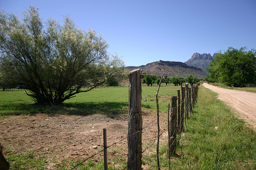
Access is via
a 3-mile unpaved but graded dirt road off Utah State Route 9 from
Rockville—suitable for most 2WD vehicles in dry conditions, though
high-clearance recommended after rain to avoid ruts. The road winds
through orchards, offering glimpses of the town before arriving at a
small parking area.
Grafton is open year-round from dawn to dusk, free of charge, with no formal entrance or reservations required—ideal for a spontaneous side trip from Zion National Park (about 10 miles away). The self-guided 0.5-mile loop trail is family-friendly and wheelchair-accessible in parts, taking 30-60 minutes to explore structures, read plaques, and visit the cemetery; download a map from graftonheritage.org or pick one up in Rockville. Best visited in spring (April-May) for blooming orchards or fall (September-October) for cooler temps (70-80°F/21-27°C) and golden foliage, avoiding midday summer heat—dawn yields ethereal light for photos, as noted in 2025 visitor posts. Pack water, sunscreen, sturdy shoes for sandy paths, and respect rules: no climbing on buildings, leave artifacts untouched, leashed pets allowed but clean up after them, and drones prohibited to preserve the peace. Flash flood risks mean checking weather via NOAA apps before entering the river-adjacent site. For deeper immersion, join occasional guided tours by the Heritage Partnership (contact via their site) or combine with a Zion shuttle stop in Rockville. Lodging abounds in Springdale or St. George, with camping at BLM sites nearby. As one August 2025 visitor shared on X, it's a "beautiful setting" evoking the Old West, but approach with reverence—Grafton isn't a theme park but a sacred echo of pioneers' dreams and struggles, where the Virgin River's murmur reminds us of time's relentless flow.